Home
Our School
New Beginnings
Our Vision and Values
Policies and Procedures
Staff
Governors
Safeguarding
Outdoor Learning
Compliments, Comments and Complaints
KS2 Data
Financial Information
Ofsted
Pupil Premium
Sport Premium
Community
General Info
Community Facilities
Lantern Festival – ‘Catch the Light’
Late Night Activities
Vacancies
Parents
School Admissions
Curriculum Information
Calendar
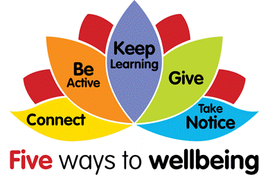
Wellbeing
E-Safety
Attendance and Punctuality
Dinner Money
Lunch Menu
Uniform
SEND
Pupils
School Council
Rewards and Shoutouts
The Hub
Nursery
Reception
Year 1
Year 2
Year 3
Year 4
Year 5
Year 6
Clubs
Clubs
Holiday Clubs
Curriculum
English
Celebrating English
Maths
Celebrating Maths…
Design Technology
Celebrating Design Technology
Computing
Celebrating Computing
Art and Design
Celebrating Art and Design
Spanish
Celebrating Spanish
Science
Celebrating Science
Little Wandle
Celebrating Little Wandle Letters and Sounds
Music
Celebrating Music
R.E
Celebrating RE
PSHE
Celebrating PSHE
History
Celebrating History
P.E
Celebrating P.E
Geography
Celebrating Geography
Contact
Home
Curriculum
Geography
Celebrating Geography
Celebrating Geography
Download
our latest newsletter
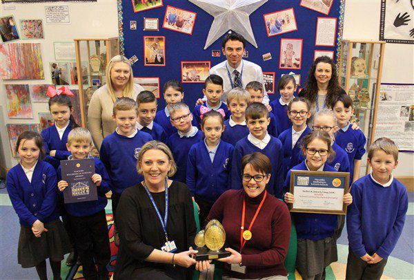
Southwick Wins School Community Award
Recent Posts
Year 6 Safety Works Visit
#WakeUp Wednesday!
Mental Health Charter Mark Gold Award!
And the winners are…
Attendance 21st March 2025
We use cookies to ensure that we give you the best experience on our website. If you continue to use this site we will assume that you are happy with it.
Ok
Privacy policy